 |
|
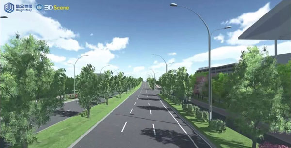
A display from a 3D high-precision map produced by BrightMap that gives every possible detail of the road [Photo provided to chinadaily.com.cn] |
The safety of self-driving cars is expected to be enhanced by a more powerful route finder in the form of a 3D high-definition map, according to Wang Xiaotao, production manager of the company producing it, BrightMap.
BrightMap, one of China's top e-map manufacturers, showcases just how easier and safer it might be for a self-driving car to move with the help of its 3D high-precision map.
According to Wang, the map not only gives a more precise location of a car, but also exactly shows road conditions -- including the road's shape, number of driveways and the gradients of slopes, lane markings, traffic lights and signs and median strips, among other things -- so that cars will know exactly where it is and make decisions accordingly.
For example, they will know if there is a junction several hundred meters ahead and automatically slow down when coming near that intersection, changing lanes if necessary. They can also be informed of the speed limit of each driveway and the type of vehicles that frequently show up at a certain junction, so to take appropriate measures to avoid a collision with another vehicle.
 |
|
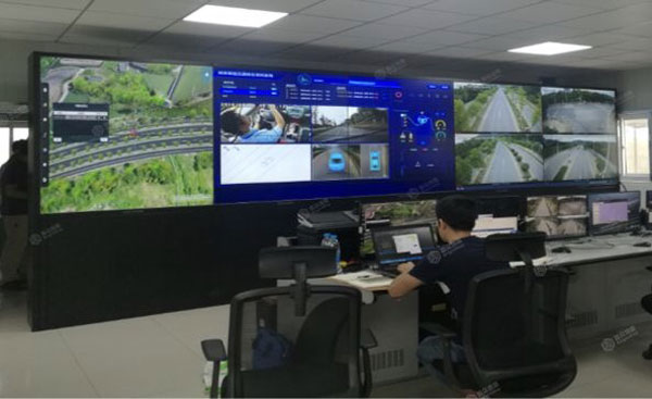
A monitoring platform developed by BrightMap, based on the 3D high-definition map, supports real-time surveillance of a self-driving car and playback of its earlier movements. [Photo provided to chinadaily.com.cn] |
"Compared with a 2D map, the navigation map we use today, which is quite abstract, the 3D map presents the real outdoor situation in front of us and can be seen on our mobile phone," Wang said.
"It plays a fundamental and technical role in the internet of things."
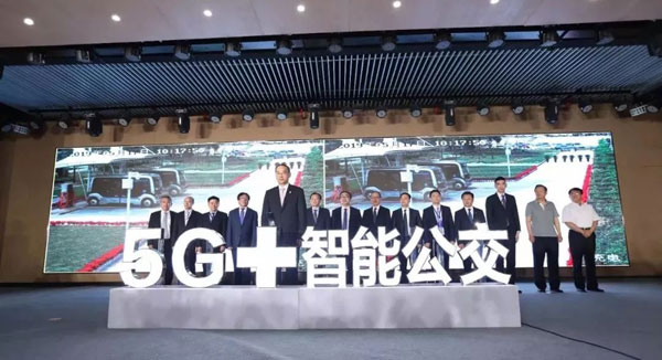
Connecting vehicles and roads more closely, the map developed by the company has been used in many key projects involving self-driving cars. They include the pilot test runs of a self-driving bus on Zhihui Island in Zhengzhou, Henan province, on May 17, the first time in the world a self-driving bus was piloted on an open road.?
 |
|
Officials launch the test run of a self-driving bus on Zhihui Island in Zhengzhou, in Henan province, on May 17. [Photo provided to chinadaily.com.cn] |
"Self-driving car manufacturing is recognized as the most promising industry of the future, and our 3D maps have been successfully been applied in the industry many times thanks to the realization of mass production by our company. Without mass production, the map would still remain in the concept stage," Wang added.